

point cloud
(point cluster)
A point cloud is a collection of three-dimensional coordinate points that represent the surface of a real or virtual object or, in other words a network of georeferenced data points. Each point in the cloud represents the position of a surface point in 3D space, and is typically represented by a set of x, y, and z coordinates. It can be created by various methods such as 3D scanning, structured light scanning, laser scanning, photogrammetry or even simulation.
A point cloud usually does not contain any other information such as colors or textures, but consists only of a collection of points with their coordinates. However, the point cloud can serve as a basis for further processing steps such as 3D modeling or metrology. Mostly point clouds are used to create 3D models of objects or environments, and can be visualized using specialized software. Point clouds are used in many application areas, such as 3D computer vision, architecture, engineering, surveying, robotics or virtual reality.
For example, such a three-dimensional point cloud might be the result of LIDAR measurements, where a spatial assignment is made for each point in the vector space by means of a big data analysis. The cloud of data points is described by the points it contains, each of which is captured by its spatial coordinates. This approach enables the representation of a surprisingly accurate 3D model of reality. In this context, the point density is an essential factor for the detection of objects and the possible resolution the in the field of visualization.
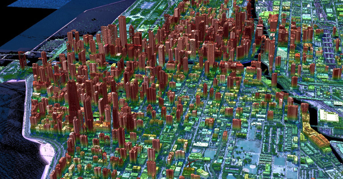
This image shows a point cloud measured using airborne lidar shows the city of Chicago, Illinois. It was measured using a Geiger mode LIDAR. Photographer: Jason Stoker, Image rights: public domain, picture has been cropped and taken from the USGS website.